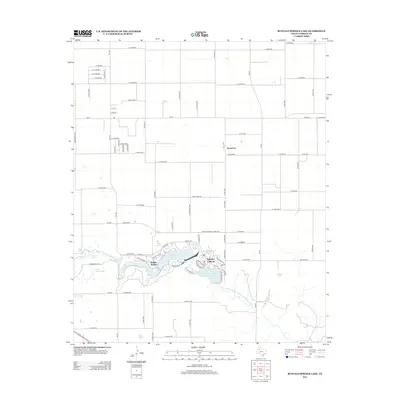
2012 Map of Buffalo Springs Lake
USGS Topo · Published 2012About this map
Buffalo Springs Lake and Lake Ransom Canyon anchor this portion of the Texas High Plains, where the N Fork Double Mountain Fork Brazos River carves through the local landscape. The map reveals the early 21st-century residential developments of Buffalo Springs and Ransom Canyon, characterized by winding drives such as Pony Express Trl and Sioux Trl.
Find a feature on this map
85 named features on this map. Tap any name to fly to it.
Don’t see what you’re looking for? This feature index may not catch every label — zoom into the map to look around manually.
Map Details
Editions of this 2012 Buffalo Springs Lake Map
This is the sole edition of this map. No revisions or reprints were ever made.
Other maps of this area

1954 · Lubbock
USGS Topo · 1:250,000

1956 · New Deal
USGS Topo · 1:24,000

1957 · Lubbock East
USGS Topo · 1:24,000

1957 · New Home
USGS Topo · 1:62,500

1957 · Lubbock
USGS Topo · 1:62,500

1965 · Acuff
USGS Topo · 1:24,000

1965 · Slaton
USGS Topo · 1:24,000

1965 · Buffalo Springs Lake
USGS Topo · 1:24,000

1965 · Slaton NE
USGS Topo · 1:24,000

1965 · Idalou
USGS Topo · 1:24,000