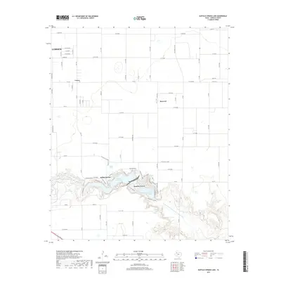
2019 Map of Buffalo Springs Lake
USGS Topo · Published 2019About this map
Yellow House Canyon cuts a distinct path through this High Plains landscape, hosting a series of reservoirs and residential developments east of Lubbock. The dramatic topography of the canyon contrasts sharply with the surrounding agricultural grid, creating a unique recreational corridor centered on Buffalo Springs Lake and Lake Ransom Canyon. These water bodies are fed by the N Fork Double Mountain Fork Brazos River, which carves through the caprock to reveal springs like Old Squeal Spring.
Find a feature on this map
86 named features on this map. Tap any name to fly to it.
Don’t see what you’re looking for? This feature index may not catch every label — zoom into the map to look around manually.
Map Details
Editions of this 2019 Buffalo Springs Lake Map
This is the sole edition of this map. No revisions or reprints were ever made.
Other maps of this area

1954 · Lubbock
USGS Topo · 1:250,000

1956 · New Deal
USGS Topo · 1:24,000

1957 · Lubbock East
USGS Topo · 1:24,000

1957 · New Home
USGS Topo · 1:62,500

1957 · Lubbock
USGS Topo · 1:62,500

1965 · Acuff
USGS Topo · 1:24,000

1965 · Slaton
USGS Topo · 1:24,000

1965 · Buffalo Springs Lake
USGS Topo · 1:24,000

1965 · Slaton NE
USGS Topo · 1:24,000

1965 · Idalou
USGS Topo · 1:24,000