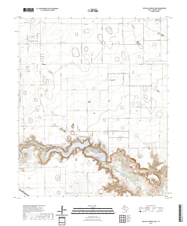
2023 Map of Buffalo Springs Lake
USGS Topo · Published 2023About this map
Yellow House Canyon carves a dramatic path through the High Plains of West Texas, sheltering a network of reservoirs and springs southeast of Lubbock. This contemporary 2023 survey documents the recreational and residential development concentrated along the North Fork Double Mountain Fork Brazos River, where Buffalo Springs Lake and Lake Ransom Canyon provide a sharp contrast to the surrounding agricultural grid. The small settlements of Buffalo Springs and Ransom Canyon are established here, while the northern reaches of the map retain an open, rural character defined by section-line roads and scattered communities like Canyon and Roosevelt. Local hydrological features such as Arnett Lake and the specifically named Big Squeal Spring highlight the essential nature of water in this semi-arid landscape. The road network, including Pony Express Trl and Chuck Wagon, hints at the area's frontier-themed identity in the modern era.
Find a feature on this map
87 named features on this map. Tap any name to fly to it.
Don’t see what you’re looking for? This feature index may not catch every label — zoom into the map to look around manually.
Map Details
Editions of this 2023 Buffalo Springs Lake Map
This is the sole edition of this map. No revisions or reprints were ever made.
Other maps of this area

1954 · Lubbock
USGS Topo · 1:250,000

1956 · New Deal
USGS Topo · 1:24,000

1957 · Lubbock East
USGS Topo · 1:24,000

1957 · New Home
USGS Topo · 1:62,500

1957 · Lubbock
USGS Topo · 1:62,500

1965 · Acuff
USGS Topo · 1:24,000

1965 · Slaton
USGS Topo · 1:24,000

1965 · Buffalo Springs Lake
USGS Topo · 1:24,000

1965 · Slaton NE
USGS Topo · 1:24,000

1965 · Idalou
USGS Topo · 1:24,000