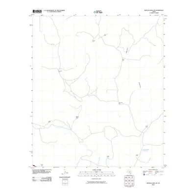
2010 Map of Buffalo Well SE
USGS Topo · Published 2010About this map
North Llano River flows across this Sutton County landscape, a vital water source in an area defined by large family holdings and sprawling ranching operations. The terrain is marked by significant drainage patterns including Buffalo Draw and Tenmile Draw, which orient the positioning of various homesteads and livestock facilities. Several generations of local ranching heritage are evident through the naming of properties such as R Hardgrave Ranch, J Hardgrave Ranch, and the clustered T Baker Ranch, D Baker Ranch, and S Baker Ranch. A distinctive local landmark, the Little Ogden Waterhole, serves as a specific point of interest for those studying the water management and historical land use of this arid region. The map reveals the persistence of rural livestock infrastructure in the early 21st century, showing how modern land divisions still reflect older survey lines and natural topographic boundaries.
Find a feature on this map
16 named features on this map. Tap any name to fly to it.
Don’t see what you’re looking for? This feature index may not catch every label — zoom into the map to look around manually.
Map Details
Editions of this 2010 Buffalo Well SE Map
This is the sole edition of this map. No revisions or reprints were ever made.
Other maps of this area

1893 · Rock Springs
USGS Topo · 1:125,000

1893 · Fort McKavett
USGS Topo · 1:125,000

1954 · Sonora
USGS Topo · 1:250,000

1958 · Sonora
USGS Topo · 1:250,000

1963 · Steen Lake
USGS Topo · 1:24,000

1963 · Buffalo Well
USGS Topo · 1:24,000

1963 · Live Oak Draw
USGS Topo · 1:24,000

1963 · Buffalo Well NW
USGS Topo · 1:24,000

1963 · Buffalo Well SE
USGS Topo · 1:24,000
1963 · Fort Terrett Ranch
USGS Topo · 1:24,000