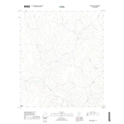
2019 Map of Buffalo Well SE
USGS Topo · Published 2019About this map
N Llano River and its accompanying North Llano Draw define the drainage patterns of this Sutton County landscape. The terrain is marked by significant intermittent waterways, including the broad Buffalo Draw and Tenmile Draw, which illustrate the arid hydrology of the Edwards Plateau. This 2019 survey shows a region largely defined by ranching infrastructure and private access, where named water features like the Little Ogden Waterhole serve as critical landmarks in an otherwise sparsely populated territory. A network of rural and private routes, such as Baker Rd and R Buck Ranch Rd, provide the primary means of navigating the local ranch lands and connecting to more established paths like Co Rd 306.
Find a feature on this map
13 named features on this map. Tap any name to fly to it.
Don’t see what you’re looking for? This feature index may not catch every label — zoom into the map to look around manually.
Map Details
Editions of this 2019 Buffalo Well SE Map
This is the sole edition of this map. No revisions or reprints were ever made.
Other maps of this area

1893 · Rock Springs
USGS Topo · 1:125,000

1893 · Fort McKavett
USGS Topo · 1:125,000

1954 · Sonora
USGS Topo · 1:250,000

1958 · Sonora
USGS Topo · 1:250,000

1963 · Steen Lake
USGS Topo · 1:24,000

1963 · Buffalo Well
USGS Topo · 1:24,000

1963 · Live Oak Draw
USGS Topo · 1:24,000

1963 · Buffalo Well NW
USGS Topo · 1:24,000

1963 · Buffalo Well SE
USGS Topo · 1:24,000
1963 · Fort Terrett Ranch
USGS Topo · 1:24,000