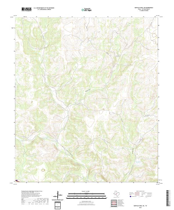
2022 Map of Buffalo Well SE
USGS Topo · Published 2022About this map
N Llano River and the seasonal drainages of the Edwards Plateau define this sparsely settled portion of Sutton County. The landscape is dominated by a complex network of dry draws, most notably Buffalo Draw, North Llano Draw, and Tenmile Draw, which illustrate the natural hydrology of the Texas Hill Country. A critical water resource for local ranching is marked at the Little Ogden Waterhole in the southeastern quadrant. This 2022 survey documents the contemporary ranching infrastructure, where named roads such as Baker Rd and the R Buck Ranch Rd provide access through the undulating terrain. While the area lacks dense municipal development, the naming of specific private roads and waterholes provides essential data for land use research and local genealogy in a region where property boundaries and water access have long shaped the community.
Find a feature on this map
13 named features on this map. Tap any name to fly to it.
Don’t see what you’re looking for? This feature index may not catch every label — zoom into the map to look around manually.
Map Details
Editions of this 2022 Buffalo Well SE Map
This is the sole edition of this map. No revisions or reprints were ever made.
Other maps of this area

1893 · Rock Springs
USGS Topo · 1:125,000

1893 · Fort McKavett
USGS Topo · 1:125,000

1954 · Sonora
USGS Topo · 1:250,000

1958 · Sonora
USGS Topo · 1:250,000

1963 · Steen Lake
USGS Topo · 1:24,000

1963 · Buffalo Well
USGS Topo · 1:24,000

1963 · Live Oak Draw
USGS Topo · 1:24,000

1963 · Buffalo Well NW
USGS Topo · 1:24,000

1963 · Buffalo Well SE
USGS Topo · 1:24,000
1963 · Fort Terrett Ranch
USGS Topo · 1:24,000