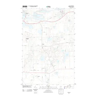
2013 Map of Buhl
USGS Topo · Published 2013About this map
Industrial mining legacies and iron range geography converge at Chisholm and Buhl, where the landscape is defined by extensive water management systems and historic transit corridors. The Sherman Group Tailings Basin north of Us-169 provides a clear view of the scale of regional extraction, contrasted by the presence of smaller residential pockets and rural junctions like Wilpen and Dunwoody Junction. Local infrastructure is anchored by the Range Regional Airport in the south, while the northern terrain is punctuated by significant water bodies such as Longyear Lake and Threemile Lake. For genealogists and local historians, the map identifies specific burial sites including Lake View Cem and Grandview Memorial Garden, alongside a complex network of named rural roads like Yuretich Rd and Bovitz Rd that trace the settlement patterns of Saint Louis County.
Find a feature on this map
65 named features on this map. Tap any name to fly to it.
Don’t see what you’re looking for? This feature index may not catch every label — zoom into the map to look around manually.
Map Details
Editions of this 2013 Buhl Map
This is the sole edition of this map. No revisions or reprints were ever made.
Other maps of this area

1951 · Kinney
USGS Topo · 1:24,000

1951 · Kirk
USGS Topo · 1:24,000

1951 · Hibbing
USGS Topo · 1:24,000

1951 · Casco
USGS Topo · 1:24,000

1951 · Buhl
USGS Topo · 1:24,000

1952 · Riley
USGS Topo · 1:24,000

1952 · Little Swan
USGS Topo · 1:24,000

1954 · Hibbing
USGS Topo · 1:250,000

1955 · Dewey Lake SE
USGS Topo · 1:24,000

1955 · Dewey Lake
USGS Topo · 1:24,000