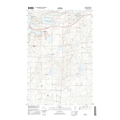
2016 Map of Buhl
USGS Topo · Published 2016About this map
Sherman Mine operations and industrial basins dominate the northern landscape of this Iron Range quadrangle, reflecting the region's deep ties to mineral extraction. In the northwest, Chisholm borders the waters of Longyear Lake, while the town of Buhl sits to the northeast, characterized by a dense grid of streets including Pennsylvania Ave and Whiteside Ave. Between these urban centers, the vast Sherman Group Tailings Basin and Sherman Mine Waste Water Basin illustrate the scale of mining's environmental footprint on the Mesabi Range.
Find a feature on this map
87 named features on this map. Tap any name to fly to it.
Don’t see what you’re looking for? This feature index may not catch every label — zoom into the map to look around manually.
Map Details
Editions of this 2016 Buhl Map
This is the sole edition of this map. No revisions or reprints were ever made.
Other maps of this area

1951 · Kinney
USGS Topo · 1:24,000

1951 · Kirk
USGS Topo · 1:24,000

1951 · Hibbing
USGS Topo · 1:24,000

1951 · Casco
USGS Topo · 1:24,000

1951 · Buhl
USGS Topo · 1:24,000

1952 · Riley
USGS Topo · 1:24,000

1952 · Little Swan
USGS Topo · 1:24,000

1954 · Hibbing
USGS Topo · 1:250,000

1955 · Dewey Lake SE
USGS Topo · 1:24,000

1955 · Dewey Lake
USGS Topo · 1:24,000