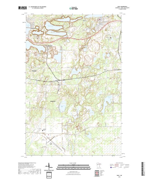
2022 Map of Buhl
USGS Topo · Published 2022About this map
The Mesabi Range defines the industrial and natural geography of this northern Minnesota landscape, where the legacy of iron mining is visible in features like the Sherman Group Tailings Basin north of Chisholm. The region is a network of specialized junctions and small settlements, including Saint Clair Junction, Dunwoody Junction, and Wilpen, connected by local routes like Hwy 92 and Maturi Rd. Recreational and transit corridors such as the Mesabi Trail Walking Path wind through a lake-rich terrain featuring Longyear Lake, Sixmile Lake, and McQuade Lake. To the south, the Range Regional Airport and Grandview Memorial Garden serve the larger population center of Hibbing, while the town of Buhl sits at the northeastern edge near Lake View Cem, illustrating the proximity of residential life to the expansive mining operations that have shaped St. Louis County.
Find a feature on this map
62 named features on this map. Tap any name to fly to it.
Don’t see what you’re looking for? This feature index may not catch every label — zoom into the map to look around manually.
Map Details
Editions of this 2022 Buhl Map
This is the sole edition of this map. No revisions or reprints were ever made.
Other maps of this area

1951 · Kinney
USGS Topo · 1:24,000

1951 · Kirk
USGS Topo · 1:24,000

1951 · Hibbing
USGS Topo · 1:24,000

1951 · Casco
USGS Topo · 1:24,000

1951 · Buhl
USGS Topo · 1:24,000

1952 · Riley
USGS Topo · 1:24,000

1952 · Little Swan
USGS Topo · 1:24,000

1954 · Hibbing
USGS Topo · 1:250,000

1955 · Dewey Lake SE
USGS Topo · 1:24,000

1955 · Dewey Lake
USGS Topo · 1:24,000