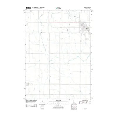
2010 Map of Buhl
USGS Topo · Published 2010About this map
The agricultural landscape of Twin Falls County is defined by a dense network of irrigation and precise section-line roads in this 2010 survey. The city of Buhl serves as the primary hub, showing a structured grid of streets including Sawtooth Ave and the nearby Buhl Municipal Airport. The importance of water management in this arid region is evident through the path of the Low Line Canal, which snakes across the terrain to support the surrounding farmland.
Find a feature on this map
21 named features on this map. Tap any name to fly to it.
Don’t see what you’re looking for? This feature index may not catch every label — zoom into the map to look around manually.
Map Details
Editions of this 2010 Buhl Map
This is the sole edition of this map. No revisions or reprints were ever made.
Other maps of this area

1949 · Thousand Springs
USGS Topo · 1:24,000

1950 · Niagara Springs
USGS Topo · 1:24,000

1950 · Jerome
USGS Topo · 1:62,500

1951 · Thousand Springs
USGS Topo · 1:24,000

1951 · Clover
USGS Topo · 1:24,000

1954 · Thousand Springs
USGS Topo · 1:24,000

1955 · Twin Falls
USGS Topo · 1:250,000

1958 · Twin Falls
USGS Topo · 1:250,000

1958 · Buhl
USGS Topo · 1:24,000

1959 · Buhl
USGS Topo · 1:62,500