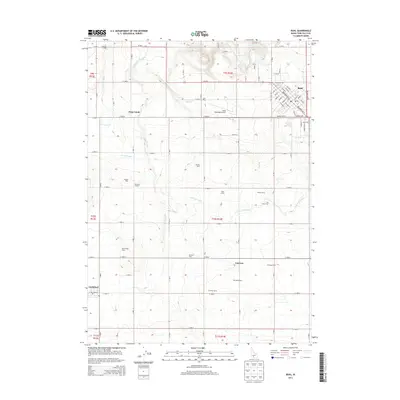
2013 Map of Buhl
USGS Topo · Published 2013About this map
Agricultural operations and irrigation networks define the landscape around Buhl, where the High Desert meets the Snake River Plain. The complex water management system is anchored by the Low Line Canal, which winds through the territory to support a high density of dairy farms, including Silva Dairy, Bokma Dairy, and Heritage Farms. The town of Buhl sits in the northeast corner of the sheet, characterized by a tight residential grid near the Buhl Municipal Airport. To the southwest, the smaller settlement of Castleford and the locality of Fairview mark the rural expanse. The drainage of Deep Creek and Mud Creek provides natural relief to the gridded section lines of the Magic Valley. These features reflect the region's enduring reliance on coordinated water systems to transform the arid plains into productive farmland.
Find a feature on this map
81 named features on this map. Tap any name to fly to it.
Don’t see what you’re looking for? This feature index may not catch every label — zoom into the map to look around manually.
Map Details
Editions of this 2013 Buhl Map
This is the sole edition of this map. No revisions or reprints were ever made.
Other maps of this area

1949 · Thousand Springs
USGS Topo · 1:24,000

1950 · Niagara Springs
USGS Topo · 1:24,000

1950 · Jerome
USGS Topo · 1:62,500

1951 · Thousand Springs
USGS Topo · 1:24,000

1951 · Clover
USGS Topo · 1:24,000

1954 · Thousand Springs
USGS Topo · 1:24,000

1955 · Twin Falls
USGS Topo · 1:250,000

1958 · Twin Falls
USGS Topo · 1:250,000

1958 · Buhl
USGS Topo · 1:24,000

1959 · Buhl
USGS Topo · 1:62,500