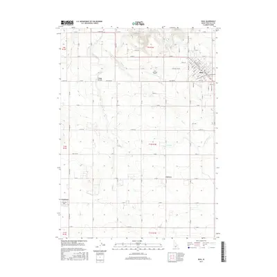
2017 Map of Buhl
USGS Topo · Published 2017About this map
The agricultural landscape of Twin Falls County is defined by an intricate network of irrigation systems and early 21st-century settlements. Buhl stands as the primary hub, with its street grid including Floral Ave and Fruitland, while the smaller communities of Fairview and Castleford anchor the surrounding rural expanse. The essential role of water management in this arid region is evident through the prominent Low Line Canal, which traverses the terrain alongside natural drainage features like Deep Creek and Mud Cr. Transport and local infrastructure are represented by the Buhl Municipal Airport and a dense section-line road network, including Melon Valley Rd. This survey illustrates the persistent geometry of Western homesteading, where the interplay of canals and creeks dictated the placement of towns and the productivity of the Snake River Plain.
Find a feature on this map
75 named features on this map. Tap any name to fly to it.
Don’t see what you’re looking for? This feature index may not catch every label — zoom into the map to look around manually.
Map Details
Editions of this 2017 Buhl Map
This is the sole edition of this map. No revisions or reprints were ever made.
Other maps of this area

1949 · Thousand Springs
USGS Topo · 1:24,000

1950 · Niagara Springs
USGS Topo · 1:24,000

1950 · Jerome
USGS Topo · 1:62,500

1951 · Thousand Springs
USGS Topo · 1:24,000

1951 · Clover
USGS Topo · 1:24,000

1954 · Thousand Springs
USGS Topo · 1:24,000

1955 · Twin Falls
USGS Topo · 1:250,000

1958 · Twin Falls
USGS Topo · 1:250,000

1958 · Buhl
USGS Topo · 1:24,000

1959 · Buhl
USGS Topo · 1:62,500