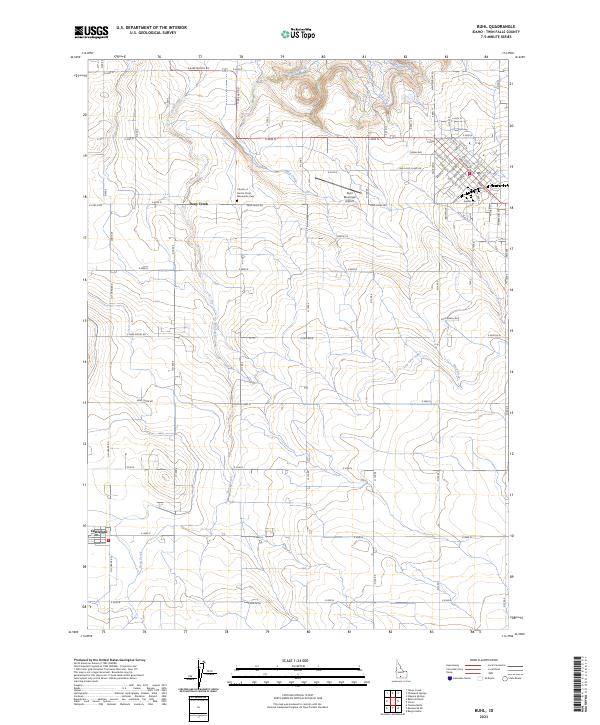
2023 Map of Buhl
USGS Topo · Published 2023About this map
Mud Creek and Deep Creek carve deep, branching drainage patterns across the irrigated plateaus of Twin Falls County. The landscape is defined by a dense, orthogonal road network serving a high-intensity agricultural district, where the Low Line Canal manages the critical flow of water. Near the northern edge of the survey, the Buhl Municipal Airport sits adjacent to the residential expansion of the area, while the Church of God in Christ and the Mennonite Cem provide anchors for the local rural community. To the southwest, the settlement of Castleford serves as a local hub, connected to the larger regional grid by arterial routes like Lewis and Clark Rd and Melon Valley Rd. This contemporary survey illustrates the enduring intersection of geological erosion and modern water management in Idaho's Snake River Plain region.
Find a feature on this map
75 named features on this map. Tap any name to fly to it.
Don’t see what you’re looking for? This feature index may not catch every label — zoom into the map to look around manually.
Map Details
Editions of this 2023 Buhl Map
This is the sole edition of this map. No revisions or reprints were ever made.
Other maps of this area

1949 · Thousand Springs
USGS Topo · 1:24,000

1950 · Niagara Springs
USGS Topo · 1:24,000

1950 · Jerome
USGS Topo · 1:62,500

1951 · Thousand Springs
USGS Topo · 1:24,000

1951 · Clover
USGS Topo · 1:24,000

1954 · Thousand Springs
USGS Topo · 1:24,000

1955 · Twin Falls
USGS Topo · 1:250,000

1958 · Twin Falls
USGS Topo · 1:250,000

1958 · Buhl
USGS Topo · 1:24,000

1959 · Buhl
USGS Topo · 1:62,500