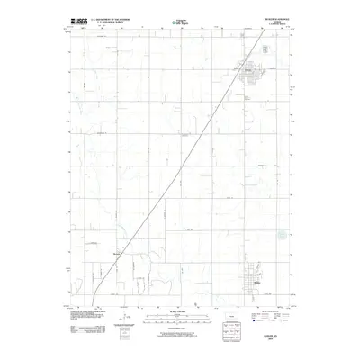
2009 Map of Buhler
USGS Topo · Published 2009About this map
Inman and Buhler serve as the primary population centers in this section of Reno County, situated along a diagonal corridor that connects them with the smaller settlement of Medora. The landscape is defined by the winding course of the Little Arkansas River, which meanders through the southern half of the quadrangle, joined by tributaries like Wolf Creek in the northwest. The grid of country roads, including Cheyenne RD and Arapaho RD, reflects the organized agricultural development typical of the Kansas plains. Genealogists will find significant local history at the Inman North Cemetery, Inman South Cemetery, and the centrally located Evergreen Cemetery, which provide a record of the area's established communities. The eastern edge is dotted with small water bodies such as Dirks Lake, while the rail and road network reinforces the connectivity between these rural hubs during the early 21st century.
Find a feature on this map
43 named features on this map. Tap any name to fly to it.
Don’t see what you’re looking for? This feature index may not catch every label — zoom into the map to look around manually.
Map Details
Editions of this 2009 Buhler Map
This is the sole edition of this map. No revisions or reprints were ever made.
Other maps of this area

1891 · Hutchinson
USGS Topo · 1:125,000

1893 · Hutchinson
USGS Topo · 1:125,000

1955 · Hutchinson
USGS Topo · 1:250,000

1959 · Hutchinson
USGS Topo · 1:250,000
1959 · Burrton
USGS Topo · 1:24,000
1960 · Hutchinson
USGS Topo · 1:24,000
1961 · Hutchinson SE
USGS Topo · 1:24,000

1964 · Windom SW
USGS Topo · 1:24,000

1964 · Conway
USGS Topo · 1:24,000

1965 · Mc Pherson South
USGS Topo · 1:24,000