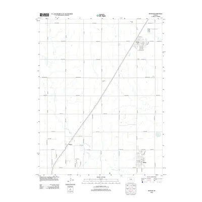
2012 Map of Buhler
USGS Topo · Published 2012About this map
Inman and Buhler anchor this section of the Kansas plains, where the rectilinear grid of the township-and-range system is interrupted only by the winding course of the Little Arkansas River. The landscape is a study in rural organization, with roads like Arrowhead Rd and Arapaho Rd cutting straight across the terrain. Small settlements like Medora sit alongside significant transportation corridors, while the area's social fabric is visible in the placement of the Evergreen Cem, N Inman Cem, and Inman S Cem. Unusual geological and recreational features, such as the Little Sinkhole and the Inman Motocross track, provide local character to the agricultural expanse. The drainage patterns of Wolf Cr and the presence of Dirks Lake illustrate the hydrology of the Arkansas River basin as it appeared in the early 21st century.
Find a feature on this map
67 named features on this map. Tap any name to fly to it.
Don’t see what you’re looking for? This feature index may not catch every label — zoom into the map to look around manually.
Map Details
Editions of this 2012 Buhler Map
This is the sole edition of this map. No revisions or reprints were ever made.
Other maps of this area

1891 · Hutchinson
USGS Topo · 1:125,000

1893 · Hutchinson
USGS Topo · 1:125,000

1955 · Hutchinson
USGS Topo · 1:250,000

1959 · Hutchinson
USGS Topo · 1:250,000
1959 · Burrton
USGS Topo · 1:24,000
1960 · Hutchinson
USGS Topo · 1:24,000
1961 · Hutchinson SE
USGS Topo · 1:24,000

1964 · Windom SW
USGS Topo · 1:24,000

1964 · Conway
USGS Topo · 1:24,000

1965 · Mc Pherson South
USGS Topo · 1:24,000