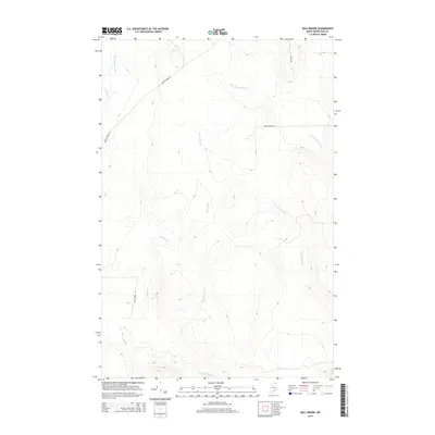
2014 Map of Bull Brook
USGS Topo · Published 2014About this map
Beaver Brook and its various tributaries define the drainage patterns of this northern Maine landscape, flowing through a region primarily shaped by timber interests and remote accessibility. The network of waterways, including Bull Brook and the W Br Salmon Brook, suggests a terrain where hydrological flow dictates the positioning of the few established thoroughfares. The road system is sparse, consisting of essential routes like Beaver Brook Rd and Bull Brook Rd that navigate the ridges between these streams. Named features such as Gardner Brook and Bugbee Brook indicate the importance of these smaller watercourses for local orientation in a heavily forested area. This 2014 survey captures the persistence of traditional land use patterns, where infrastructure is minimal and the natural geography of the Aroostook County woods remains the dominant feature.
Find a feature on this map
11 named features on this map. Tap any name to fly to it.
Don’t see what you’re looking for? This feature index may not catch every label — zoom into the map to look around manually.
Map Details
Editions of this 2014 Bull Brook Map
This is the sole edition of this map. No revisions or reprints were ever made.
Other maps of this area

1929 · Portage
USGS Topo · 1:62,500

1929 · Caribou
USGS Topo · 1:48,000

1931 · Ashland
USGS Topo · 1:48,000

1931 · Portage
USGS Topo · 1:62,500

1932 · Caribou
USGS Topo · 1:62,500

1934 · Ashland
USGS Topo · 1:62,500

1935 · Presque Isle
USGS Topo · 1:62,500

1953 · Ashland
USGS Topo · 1:62,500

1953 · Portage
USGS Topo · 1:62,500

1953 · Presque Isle
USGS Topo · 1:62,500