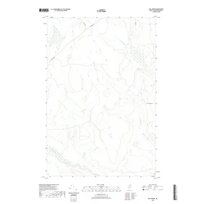
2018 Map of Bull Brook
USGS Topo · Published 2018About this map
Bull Brook and its many tributaries carve through this interior portion of Aroostook County, defining a landscape of complex wetlands and drainage patterns. The 2018 survey reveals a territory predominantly shaped by its hydrography, where the Gardner Brook and Bugbee Brook systems converge amidst varying elevations. Human imprint is confined to a sparse network of forest and access roads, including Beaver Brook Rd and New Dunn Town Rd, which navigate the rises between low-lying marshlands. This map illustrates the intersection of headwater streams like the W Br Salmon Brook and E Br Beaver Brook, providing a detailed look at the drainage basins that support the North Woods ecosystem. The lack of concentrated settlement highlights the area's primary character as a managed timber or conservation landscape where water dictates the path of travel.
Find a feature on this map
11 named features on this map. Tap any name to fly to it.
Don’t see what you’re looking for? This feature index may not catch every label — zoom into the map to look around manually.
Map Details
Editions of this 2018 Bull Brook Map
This is the sole edition of this map. No revisions or reprints were ever made.
Other maps of this area

1929 · Portage
USGS Topo · 1:62,500

1929 · Caribou
USGS Topo · 1:48,000

1931 · Ashland
USGS Topo · 1:48,000

1931 · Portage
USGS Topo · 1:62,500

1932 · Caribou
USGS Topo · 1:62,500

1934 · Ashland
USGS Topo · 1:62,500

1935 · Presque Isle
USGS Topo · 1:62,500

1953 · Ashland
USGS Topo · 1:62,500

1953 · Portage
USGS Topo · 1:62,500

1953 · Presque Isle
USGS Topo · 1:62,500