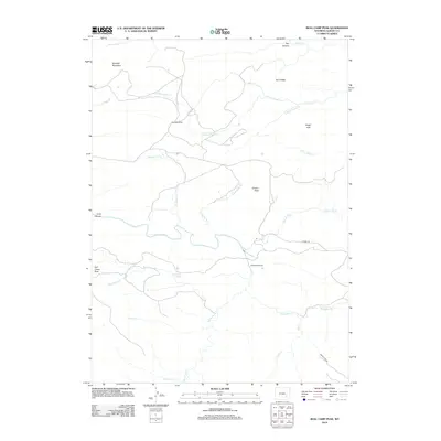
2012 Map of Bull Camp Peak
USGS Topo · Published 2012About this map
Kennedy Ranch sits at the heart of this high-plains landscape in Albany County, where the hydrology of the Laramie Mountains is carefully managed. A notable engineering feature is the Wheatland Tunnel, which redirects water through the terrain to support the region's agricultural interests. The map shows a complex drainage network including N Fork Cherry Cr, Bluegrass Cr, and Dipping Vat Cr, winding between significant elevations like Douthitt Mountain and Bull Camp Peak. This area is characterized by vast ranchlands and high ridges such as Tony Ridge, connected by specialized routes like Tunnel Rd and Power Line Rd. Small landmarks like Cottonwood Spring and Elmers Rock provide orientation in a territory defined more by its creek systems and mountain summits than by dense settlement.
Find a feature on this map
27 named features on this map. Tap any name to fly to it.
Don’t see what you’re looking for? This feature index may not catch every label — zoom into the map to look around manually.
Map Details
Editions of this 2012 Bull Camp Peak Map
This is the sole edition of this map. No revisions or reprints were ever made.
Other maps of this area

1954 · Torrington
USGS Topo · 1:250,000

1954 · Cheyenne
USGS Topo · 1:250,000

1955 · Poe Mountain
USGS Topo · 1:24,000

1955 · Dodge Ranch
USGS Topo · 1:24,000

1955 · Bluegrass Wells
USGS Topo · 1:24,000

1955 · Moonshine Peak
USGS Topo · 1:24,000

1955 · Guide Rock
USGS Topo · 1:24,000

1955 · Bull Camp Peak
USGS Topo · 1:24,000

1958 · Cheyenne
USGS Topo · 1:250,000

1958 · Torrington
USGS Topo · 1:250,000