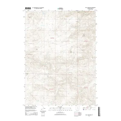
2015 Map of Bull Camp Peak
USGS Topo · Published 2015About this map
The Laramie Mountains dominate this high-altitude landscape in Albany County, where complex hydrology and water management define the terrain. Central to this system is the Wheatland Tunnel, an engineering feature that redirects water from the Laramie River through the mountains to support downstream needs. The map documents numerous cattle-ranching and agricultural water sources, including the Shellhart Fish and Stock Reservoir and Cottonwood Spring, alongside creatively named drainages like Dipping Vat Cr.
Find a feature on this map
33 named features on this map. Tap any name to fly to it.
Don’t see what you’re looking for? This feature index may not catch every label — zoom into the map to look around manually.
Map Details
Editions of this 2015 Bull Camp Peak Map
This is the sole edition of this map. No revisions or reprints were ever made.
Other maps of this area

1954 · Torrington
USGS Topo · 1:250,000

1954 · Cheyenne
USGS Topo · 1:250,000

1955 · Poe Mountain
USGS Topo · 1:24,000

1955 · Dodge Ranch
USGS Topo · 1:24,000

1955 · Bluegrass Wells
USGS Topo · 1:24,000

1955 · Moonshine Peak
USGS Topo · 1:24,000

1955 · Guide Rock
USGS Topo · 1:24,000

1955 · Bull Camp Peak
USGS Topo · 1:24,000

1958 · Cheyenne
USGS Topo · 1:250,000

1958 · Torrington
USGS Topo · 1:250,000