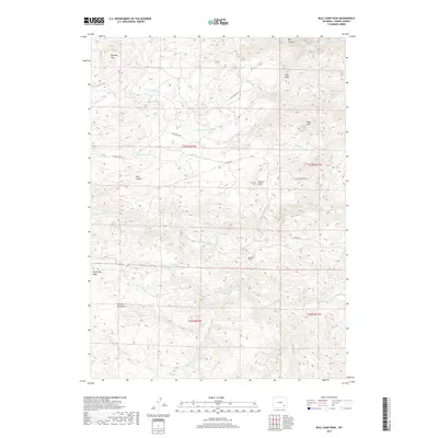
2017 Map of Bull Camp Peak
USGS Topo · Published 2017About this map
Bull Camp Peak rises as a prominent landmark within the Laramie Mountains in this high-altitude portion of Wyoming. The landscape is defined by the winding course of the Laramie River, which cuts through the central sections of the map, and the sophisticated irrigation or transport engineering represented by the Wheatland Tunnel. This high-country region is crisscrossed by numerous seasonal and perennial watercourses, including Bluegrass Cr and Bull Camp Cr, which drain the complex terrain of Tony Ridge and Sugar Loaf. A network of ranch roads and historical routes like Vale Ranch Rd and Tunnel Rd link isolated features such as Cottonwood Spring and School Cr, suggesting a rural economy tied to the land's hydrology and grazing potential.
Find a feature on this map
33 named features on this map. Tap any name to fly to it.
Don’t see what you’re looking for? This feature index may not catch every label — zoom into the map to look around manually.
Map Details
Editions of this 2017 Bull Camp Peak Map
This is the sole edition of this map. No revisions or reprints were ever made.
Other maps of this area

1954 · Torrington
USGS Topo · 1:250,000

1954 · Cheyenne
USGS Topo · 1:250,000

1955 · Poe Mountain
USGS Topo · 1:24,000

1955 · Dodge Ranch
USGS Topo · 1:24,000

1955 · Bluegrass Wells
USGS Topo · 1:24,000

1955 · Moonshine Peak
USGS Topo · 1:24,000

1955 · Guide Rock
USGS Topo · 1:24,000

1955 · Bull Camp Peak
USGS Topo · 1:24,000

1958 · Cheyenne
USGS Topo · 1:250,000

1958 · Torrington
USGS Topo · 1:250,000