
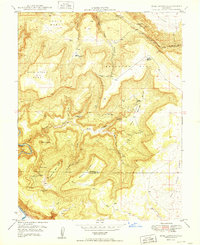
1949 Map of Bull Canyon
USGS Topo · Published 1949About this map
Wild Steer Mines and Monogram Mines anchor this 1940s landscape, reflecting the intensive mineral exploration managed by the United States Atomic Energy Commission. The terrain is defined by massive formations like Skein Mesa and Monogram Mesa, where early industrial access is marked by the Monogram Truck Trail. At lower elevations, the Dolores River cuts through the southwestern corner, while deep erosional features like Bull Canyon and Corral Draw reveal the area's complex geology. Human activity is evidenced by scattered outposts such as Indian Henrys Cabin and Wedding Bell Camp, providing a window into the remote living conditions of miners and ranchers. The presence of numerous specialized workings, including the Teapot Dome No 2 Mine and Ground Hog Mine, highlights the era's focus on heavy mineral extraction across the Montrose and San Miguel county line.
Find a feature on this map
32 named features on this map. Tap any name to fly to it.
Don’t see what you’re looking for? This feature index may not catch every label — zoom into the map to look around manually.
Map Details
Editions of this 1949 Bull Canyon Map
2 editions found
Other maps of this area

1916 · Paradox Valley
USGS Topo · 1:125,000

1922 · Paradox Valley
USGS Topo · 1:125,000

1948 · Bull Canyon
USGS Topo · 1:24,000

1948 · Horse Range Mesa
USGS Topo · 1:24,000

1948 · Uravan
USGS Topo · 1:24,000

1948 · Hamm Canyon
USGS Topo · 1:24,000

1948 · Naturita NW
USGS Topo · 1:24,000

1948 · Paradox
USGS Topo · 1:24,000

1948 · Gypsum Gap
USGS Topo · 1:24,000

1949 · Davis Mesa
USGS Topo · 1:24,000