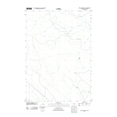
2012 Map of Bull Creek Butte
USGS Topo · Published 2012About this map
Bull Creek Butte stands as a prominent landmark in this segment of Butte County, where the landscape is defined by an extensive network of drainage systems. The map illustrates a ranching economy established along the watercourses, with several family-named properties including Coe Ranch in the north and Waite Ranch to the south. Transportation in this era relied on localized corridors such as Kiplinger-Beals Rd and Gates-Waite Rd, which connected these remote holdings across the drainage divides.
Find a feature on this map
17 named features on this map. Tap any name to fly to it.
Don’t see what you’re looking for? This feature index may not catch every label — zoom into the map to look around manually.
Map Details
Editions of this 2012 Bull Creek Butte Map
This is the sole edition of this map. No revisions or reprints were ever made.
Other maps of this area

1901 · Aladdin
USGS Topo · 1:125,000

1903 · Aladdin
USGS Topo · 1:125,000

1905 · Indian
USGS Topo · 1:62,500

1907 · Belle Fourche
USGS Topo · 1:125,000

1907 · Redwater
USGS Topo · 1:62,500

1953 · Rapid City
USGS Topo · 1:250,000

1954 · The Forks
USGS Topo · 1:24,000
1954 · Belle Fourche
USGS Topo · 1:24,000

1954 · Gillette
USGS Topo · 1:250,000

1955 · Gillette
USGS Topo · 1:250,000