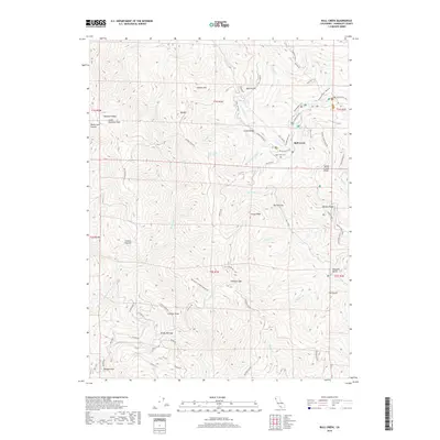
2018 Map of Bull Creek
USGS Topo · Published 2018About this map
Bull Creek and the surrounding Humboldt County wilderness are defined by a complex network of ridges and drainages that have historically supported logging and small-scale settlement. The presence of Indian Orchard and the Bull Creek Cem suggests early pioneer subsistence and community roots amidst the steep terrain of Rainbow Ridge and Cuneo Ridge. Transportation in this era relied on a mix of legacy paths like the Homestead Trail and Thornton Trail, alongside modern industrial corridors such as the HRC Logging Rd and the Old Pacific Lumber Logging Rd. To the south, the landscape opens slightly at Powder Flat along the Upper N Fork Mattole River, while northern elevations are punctuated by landmarks like Thomas Hill and South Rainbow Peak. This survey provides a record of the remote interior where resource extraction and conservation boundaries intersect.
Find a feature on this map
71 named features on this map. Tap any name to fly to it.
Don’t see what you’re looking for? This feature index may not catch every label — zoom into the map to look around manually.
Map Details
Editions of this 2018 Bull Creek Map
This is the sole edition of this map. No revisions or reprints were ever made.
Other maps of this area

1919 · Glynn
USGS Topo · 1:62,500

1920 · Pt. Delagda
USGS Topo · 1:62,500

1921 · Dyerville
USGS Topo · 1:62,500

1921 · Briceland
USGS Topo · 1:62,500

1949 · Eureka
USGS Topo · 1:250,000

1949 · Point Delgada
USGS Topo · 1:62,500

1949 · Garberville
USGS Topo · 1:62,500

1949 · Weott
USGS Topo · 1:62,500

1950 · Scotia
USGS Topo · 1:62,500

1951 · Scotia
USGS Topo · 1:62,500