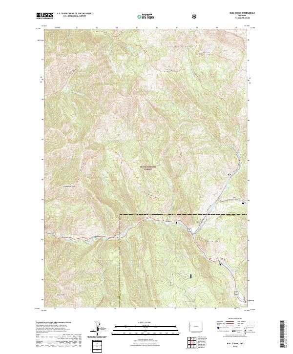
2021 Map of Bull Creek
USGS Topo · Published 2021About this map
The Hoback River flows through the southern reaches of this landscape, marking a vital watercourse within the Snake River Headwaters Wild and Scenic River system. This mountainous terrain in the Gros Ventre Range is characterized by high-elevation peaks including Cream Puff Peak, Battle Mtn, and Beaver Mtn. Managed as part of the Teton National Forest, the area is defined by its drainage networks, where Bull Cr, Horse Cr, and Little Granite Cr carve through the steep topography.
Find a feature on this map
30 named features on this map. Tap any name to fly to it.
Don’t see what you’re looking for? This feature index may not catch every label — zoom into the map to look around manually.
Map Details
Editions of this 2021 Bull Creek Map
This is the sole edition of this map. No revisions or reprints were ever made.
Other maps of this area

1907 · Gros Ventre
USGS Topo · 1:125,000

1910 · Gros Ventre
USGS Topo · 1:125,000

1931 · Jackson
USGS Topo · 1:125,000

1935 · Jackson
USGS Topo · 1:125,000

1955 · Driggs
USGS Topo · 1:250,000

1958 · Driggs
USGS Topo · 1:250,000

1962 · Driggs
USGS Topo · 1:250,000

1965 · Camp Davis
USGS Topo · 1:24,000
1965 · Turquoise Lake
USGS Topo · 1:24,000
1965 · Cache Creek
USGS Topo · 1:24,000