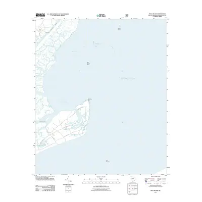
2011 Map of Bull Island
USGS Topo · Published 2011About this map
Bull Island and the complex salt marshes of the South Carolina coast define this 2011 survey, showing a landscape shaped by shifting sands and tidal currents. The island itself is crisscrossed by established tracks such as Old Fort Rd, Sheep Head Ridge Rd, and Lighthouse Rd, which navigate between interior water bodies like Big Pond and Moccasin Pond. These roads suggest a history of habitation and land management on the island, separated from the mainland by the Intracoastal Waterway and Bull Harbor. To the north, Wilson Cemetery and Sewee Camp Creek provide points of interest for genealogists and local historians, while the surrounding waters of Bulls Bay are dotted with navigational hazards including Bird Island Shoal and the Bull Breakers. This modern data provides a clear view of the relationship between the low-lying barrier islands and the mainland.
Find a feature on this map
25 named features on this map. Tap any name to fly to it.
Don’t see what you’re looking for? This feature index may not catch every label — zoom into the map to look around manually.
Map Details
Editions of this 2011 Bull Island Map
This is the sole edition of this map. No revisions or reprints were ever made.
Other maps of this area

1919 · Capers Island
USGS Topo · 1:21,120

1919 · Bulls Island
USGS Topo · 1:21,120

1919 · Sewee Bay
USGS Topo · 1:21,120

1942 · Mc Clellanville
USGS Topo · 1:24,000

1943 · Capers Island
USGS Topo · 1:24,000

1943 · Sewee Bay
USGS Topo · 1:24,000

1943 · Bulls Island
USGS Topo · 1:24,000

1943 · Awendaw
USGS Topo · 1:24,000

1943 · Ocean Bay
USGS Topo · 1:24,000

1948 · James Island
USGS Topo · 1:250,000