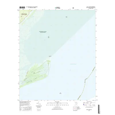
2017 Map of Bull Island
USGS Topo · Published 2017About this map
Bull Island and the surrounding coastal marshlands define this section of the South Carolina shore, where the Atlantic Ocean meets the intricate estuaries of the Cape Romain National Wildlife Refuge. The island itself is crisscrossed by historic tracks like Old Fort Rd and Lighthouse Rd, serving as a barrier between the open sea and Bulls Bay. To the northwest, the edge of the Francis Marion National Forest contains the Wilson Cem, a significant point for local genealogical research near the Intracoastal Waterway. The landscape is dominated by freshwater and brackish features including Big Pond, Upper Summerhouse Pond, and Moccasin Pond, illustrating the fragile hydrological balance of this protected wilderness area. Maritime navigation is marked by Bird Island Shoal and the Bull Breakers along the shifting coast.
Find a feature on this map
28 named features on this map. Tap any name to fly to it.
Don’t see what you’re looking for? This feature index may not catch every label — zoom into the map to look around manually.
Map Details
Editions of this 2017 Bull Island Map
This is the sole edition of this map. No revisions or reprints were ever made.
Other maps of this area

1919 · Capers Island
USGS Topo · 1:21,120

1919 · Bulls Island
USGS Topo · 1:21,120

1919 · Sewee Bay
USGS Topo · 1:21,120

1942 · Mc Clellanville
USGS Topo · 1:24,000

1943 · Capers Island
USGS Topo · 1:24,000

1943 · Sewee Bay
USGS Topo · 1:24,000

1943 · Bulls Island
USGS Topo · 1:24,000

1943 · Awendaw
USGS Topo · 1:24,000

1943 · Ocean Bay
USGS Topo · 1:24,000

1948 · James Island
USGS Topo · 1:250,000