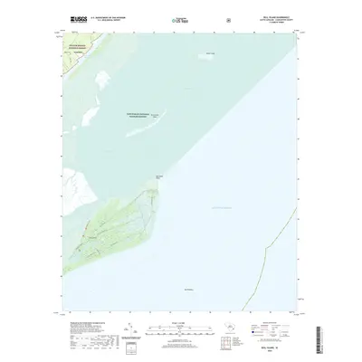
2020 Map of Bull Island
USGS Topo · Published 2020About this map
Bull Island and the surrounding coastal marshlands define this survey of the South Carolina shoreline near Awendaw. The landscape is dominated by the intersection of protected wilderness and maritime history, with the Francis Marion National Forest meeting the Cape Romain National Wildlife Refuge. The map provides a detailed view of the island's interior road and trail network, including Old Fort Rd, Sheep Head Ridge Rd, and the Turkey Walk Trail.
Find a feature on this map
26 named features on this map. Tap any name to fly to it.
Don’t see what you’re looking for? This feature index may not catch every label — zoom into the map to look around manually.
Map Details
Editions of this 2020 Bull Island Map
This is the sole edition of this map. No revisions or reprints were ever made.
Other maps of this area

1919 · Capers Island
USGS Topo · 1:21,120

1919 · Bulls Island
USGS Topo · 1:21,120

1919 · Sewee Bay
USGS Topo · 1:21,120

1942 · Mc Clellanville
USGS Topo · 1:24,000

1943 · Capers Island
USGS Topo · 1:24,000

1943 · Sewee Bay
USGS Topo · 1:24,000

1943 · Bulls Island
USGS Topo · 1:24,000

1943 · Awendaw
USGS Topo · 1:24,000

1943 · Ocean Bay
USGS Topo · 1:24,000

1948 · James Island
USGS Topo · 1:250,000