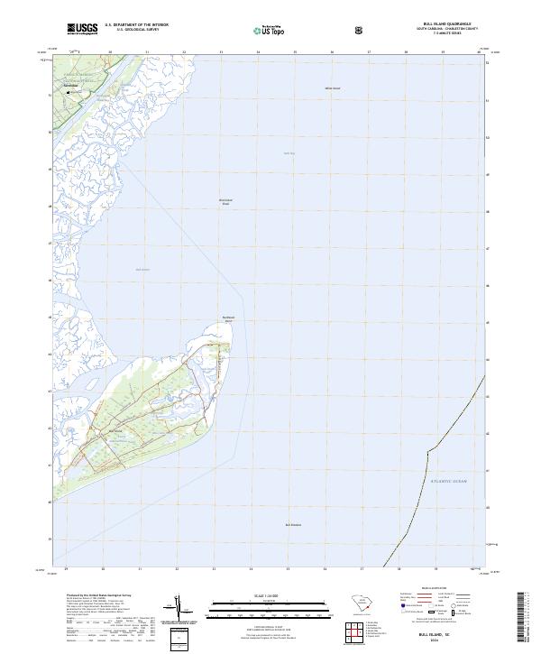
2024 Map of Bull Island
USGS Topo · Published 2024About this map
Bull Island dominates this coastal landscape, serving as a primary component of the Cape Romain National Wildlife Refuge. The map reveals a sophisticated network of internal roads and trails, such as Old Fort Rd and Sheep Head Ridge Rd, which traverse the island between freshwater features like Big Pond and Moccasin Pond. On the mainland, the settlement of Awendaw is positioned near the Intracoastal Waterway, with the Wilson Cem providing a point of genealogical interest within the Francis Marion National Forest. The geography is defined by the dynamic intersection of land and sea, where Bulls Bay and Bull Harbor provide sheltered waters behind protective formations like Bird Island Shoal and White Island. This detailed survey offers a clear view of the protected Cape Romain Wilderness as it stands in the modern era, documenting the precise shoreline of the Atlantic Ocean.
Find a feature on this map
29 named features on this map. Tap any name to fly to it.
Don’t see what you’re looking for? This feature index may not catch every label — zoom into the map to look around manually.
Map Details
Editions of this 2024 Bull Island Map
This is the sole edition of this map. No revisions or reprints were ever made.
Other maps of this area

1919 · Capers Island
USGS Topo · 1:21,120

1919 · Bulls Island
USGS Topo · 1:21,120

1919 · Sewee Bay
USGS Topo · 1:21,120

1942 · Mc Clellanville
USGS Topo · 1:24,000

1943 · Capers Island
USGS Topo · 1:24,000

1943 · Sewee Bay
USGS Topo · 1:24,000

1943 · Bulls Island
USGS Topo · 1:24,000

1943 · Awendaw
USGS Topo · 1:24,000

1943 · Ocean Bay
USGS Topo · 1:24,000

1948 · James Island
USGS Topo · 1:250,000