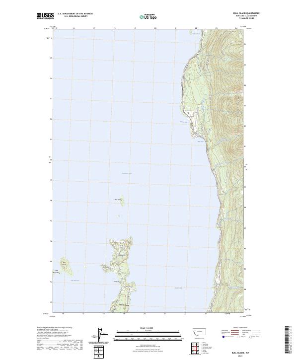
2024 Map of Bull Island
USGS Topo · Published 2024About this map
Flathead Lake dominates this portion of Lake County, where the steep western slopes of the Mission Range meet the shoreline. The settlement at Finley Point serves as a primary geographic anchor, extending into the water to create the sheltered Skidoo Bay. The map highlights the rugged interaction between the mountains and the lake, with several smaller islands including Bull Island, Little Bull Island, and the isolated Bird Island dotting the waters near The Narrows.
Find a feature on this map
34 named features on this map. Tap any name to fly to it.
Don’t see what you’re looking for? This feature index may not catch every label — zoom into the map to look around manually.
Map Details
Editions of this 2024 Bull Island Map
This is the sole edition of this map. No revisions or reprints were ever made.
Other maps of this area

1920 · Flathead Lake
USGS Topo · 1:125,000

1955 · Choteau
USGS Topo · 1:250,000

1956 · Wallace
USGS Topo · 1:250,000

1957 · Choteau
USGS Topo · 1:250,000

1958 · Choteau
USGS Topo · 1:250,000

1960 · Wallace
USGS Topo · 1:250,000

1962 · Choteau
USGS Topo · 1:250,000

1964 · Bull Island
USGS Topo · 1:24,000

1964 · Wild Horse Island
USGS Topo · 1:24,000

1964 · East Bay
USGS Topo · 1:24,000