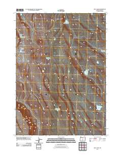
2011 Map of Bull Lake
USGS Topo · Published 2011About this map
Bull Lake and a series of specialized water sources define this high desert landscape in Lake County. This 2011 survey by the U.S. Geological Survey captures a sparsely settled region where survival and land use revolve around critical water points. Named features like Broken Coffee Pot Waterhole and King Dogs Waterhole suggest a history of ranching and livestock management, providing essential landmarks for local navigation and history. The map also details the distinct basins of Whiskey Lake and East Whiskey Lake, alongside other scattered sources such as Sheep Rock Waterhole and Camp Tank Waterhole. For the researcher, these labels offer a look at how the arid terrain of southern Oregon was organized around these vital hydrologic features at the start of the 21st century.
Find a feature on this map
8 named features on this map. Tap any name to fly to it.
Don’t see what you’re looking for? This feature index may not catch every label — zoom into the map to look around manually.
Map Details
Editions of this 2011 Bull Lake Map
This is the sole edition of this map. No revisions or reprints were ever made.
Other maps of this area

1955 · Crescent
USGS Topo · 1:250,000

1955 · Klamath Falls
USGS Topo · 1:250,000

1957 · Crescent
USGS Topo · 1:250,000

1958 · Crescent
USGS Topo · 1:250,000

1958 · Klamath Falls
USGS Topo · 1:250,000

1970 · Crescent
USGS Topo · 1:250,000

1974 · Lake Abert
USGS Topo · 1:100,000

1985 · Sharp Top
USGS Topo · 1:24,000
1985 · Fire Lake
USGS Topo · 1:24,000
1985 · Biscuit Point
USGS Topo · 1:24,000