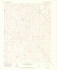
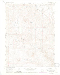
1963 Map of Bull Mountain
USGS Topo · Published 1967About this map
The Gunnison National Forest high country is documented here during the early 1960s, showing a landscape defined by seasonal ranching and early resource extraction. Named ranching sites like the Harry Parker Place and Hotchkiss Sheep Camp indicate the grazing patterns of the era, while the isolated Gas Well near North Fork Henderson Creek signals the arrival of industrial interests in the backcountry. A network of pack trails and primitive roads connects these outposts across the high-altitude terrain of Buck Mesa and Bar K Basin. Water management is prominent through features like Aspen Leaf Reservoir and Ault Reservoir, which served the livestock and agricultural needs of the surrounding valleys. The map also captures curiously named landmarks like Condemn It Park, providing specific points of interest for local historians and genealogists tracing early twentieth-century land use.
Find a feature on this map
36 named features on this map. Tap any name to fly to it.
Don’t see what you’re looking for? This feature index may not catch every label — zoom into the map to look around manually.
Map Details
Editions of this 1963 Bull Mountain Map
5 editions found
Other maps of this area

1938 · Mt. Gunnison
USGS Topo · 1:48,000

1945 · Mount Gunnison
USGS Topo · 1:62,500

1956 · Montrose
USGS Topo · 1:250,000

1957 · Leadville
USGS Topo · 1:250,000

1959 · Leadville
USGS Topo · 1:250,000

1959 · Montrose
USGS Topo · 1:250,000

1960 · Leadville
USGS Topo · 1:250,000

1960 · Montrose
USGS Topo · 1:250,000

1961 · Electric Mountain
USGS Topo · 1:24,000

1961 · Spruce Mountain
USGS Topo · 1:24,000