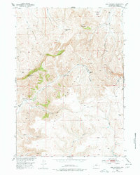
1952 Map of Bull Mountain
USGS Topo · Published 1978About this map
The High Plains of Wyoming meet the southern Bighorn Basin in this 1950s survey, illustrating a landscape defined by cattle ranching and seasonal watercourses. Large family holdings like the Justin McCarthy Ranch, Edwards Ranch, and Cochran Ranch are scattered across the drainage basins, marking the vital water sources required for livestock in this arid environment. The map details a complex network of ephemeral creeks, including Nowater Creek and Bridger Creek, which carve through the terrain between prominent landmarks like Bull Mountain and Klondike Peak.
Find a feature on this map
20 named features on this map. Tap any name to fly to it.
Don’t see what you’re looking for? This feature index may not catch every label — zoom into the map to look around manually.
Map Details
Editions of this 1952 Bull Mountain Map
3 editions found
Other maps of this area

1952 · Cottonwood Pass
USGS Topo · 1:24,000

1952 · Rathbun Ranch
USGS Topo · 1:24,000

1952 · Arapahoe Butte
USGS Topo · 1:24,000

1952 · De Pass
USGS Topo · 1:24,000

1952 · Battle Mountain
USGS Topo · 1:24,000

1952 · Bull Mountain
USGS Topo · 1:24,000

1955 · Arminto
USGS Topo · 1:250,000

1957 · Rathbun Ranch
USGS Topo · 1:24,000

1958 · Arminto
USGS Topo · 1:250,000

1960 · Packsaddle Creek
USGS Topo · 1:24,000