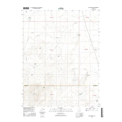
2017 Map of Bull Mountain
USGS Topo · Published 2017About this map
Bull Mountain and the surrounding peaks of the Henry Mountains dominate this high-desert landscape at the border of Wayne and Garfield counties. The terrain is defined by a network of drainage features including Cow Wash, Granite Wash, and Halfway Wash, which cut through the high plateaus and mesas. Human presence is represented by a series of ranch and resource roads, such as Fairview Ranch Rd, Energy Fuel Rd, and Granite Ranch Rd, which provide access to this isolated region. In a landscape where water is scarce, the map identifies critical survival points such as Goatwater Spring, Twin Seeps, and the East Gate Reservoir. Significant landforms like Adams Butte and Blue Knoll provide navigational landmarks across the Burr Desert.
Find a feature on this map
31 named features on this map. Tap any name to fly to it.
Don’t see what you’re looking for? This feature index may not catch every label — zoom into the map to look around manually.
Map Details
Editions of this 2017 Bull Mountain Map
This is the sole edition of this map. No revisions or reprints were ever made.
Other maps of this area

1885 · San Rafael
USGS Topo · 1:250,000

1952 · Mount Ellen 4 SW
USGS Topo · 1:24,000

1952 · Mt. Ellen 4 NW
USGS Topo · 1:24,000

1952 · Bull Mountain
USGS Topo · 1:62,500

1954 · Mt. Ellen 2 SE
USGS Topo · 1:24,000

1954 · Mt. Ellen 1 SW
USGS Topo · 1:24,000

1954 · Factory Butte
USGS Topo · 1:62,500

1956 · Salina
USGS Topo · 1:250,000

1960 · Salina
USGS Topo · 1:250,000

1962 · Salina
USGS Topo · 1:250,000