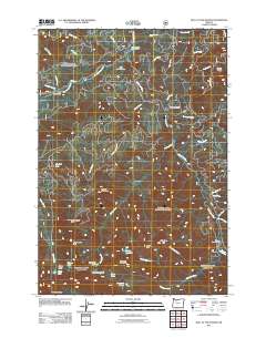
2011 Map of Bull of the Woods
USGS Topo · Published 2011About this map
The Collawash River and its numerous tributaries, including Hot Springs Fork, define the drainage patterns of this high-elevation landscape in the early 21st century. Primitive backcountry infrastructure is documented through sites like the Alder Swamp Shelter and Dutch Creek Shelter, alongside established recreational points such as the Little Fan Creek Campground and Oh Boy Forest Camp. The topography is punctuated by prominent summits including North Dickey Peak, Big Slide Mountain, and the namesake Bull of the Woods lookout point. This era of forest management is reflected in the network of Forest Service routes like Bagby Rd and Granite Peak Rd, which provide access to a cluster of alpine water bodies including Lake Lenore, Pansy Lake, and Lily Pad Lake.
Find a feature on this map
52 named features on this map. Tap any name to fly to it.
Don’t see what you’re looking for? This feature index may not catch every label — zoom into the map to look around manually.
Map Details
Editions of this 2011 Bull of the Woods Map
This is the sole edition of this map. No revisions or reprints were ever made.
Other maps of this area

1916 · Estacada
USGS Topo · 1:125,000

1924 · Mount Hood
USGS Topo · 1:125,000

1927 · Mount Hood
USGS Topo · 1:125,000

1927 · Mt. Jefferson
USGS Topo · 1:125,000

1929 · Mill City
USGS Topo · 1:125,000

1930 · Mt. Jefferson
USGS Topo · 1:125,000

1948 · Vancouver
USGS Topo · 1:250,000

1950 · Vancouver
USGS Topo · 1:250,000

1950 · Vancouver
USGS Topo · 1:250,000

1953 · Salem
USGS Topo · 1:250,000