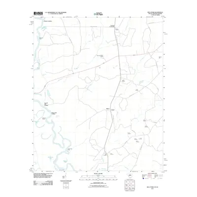
2011 Map of Bull Pond
USGS Topo · Published 2011About this map
The Savannah River floodplain defines this South Carolina landscape, where a series of landings and oxbow features trace the historical reliance on the waterway for transport and industry. Along the winding riverbanks, sites like Johnsons Landing, Fennell Hill Landing, and Blacks Landing mark traditional access points, while numerous water bodies such as Dead River Lake, Brierpatch Lake, and Ferguson Lake indicate the shifting course of the river over time.
Find a feature on this map
48 named features on this map. Tap any name to fly to it.
Don’t see what you’re looking for? This feature index may not catch every label — zoom into the map to look around manually.
Map Details
Editions of this 2011 Bull Pond Map
This is the sole edition of this map. No revisions or reprints were ever made.
Other maps of this area

1919 · Allendale
USGS Topo · 1:62,500

1920 · Ellenton
USGS Topo · 1:48,000

1920 · Hilltonia
USGS Topo · 1:62,500

1920 · Peeples
USGS Topo · 1:62,500

1921 · Ellenton
USGS Topo · 1:62,500

1943 · Allendale
USGS Topo · 1:62,500

1943 · Hilltonia
USGS Topo · 1:62,500

1943 · Peeples
USGS Topo · 1:62,500

1943 · Augusta East
USGS Topo · 1:125,000

1943 · Millen
USGS Topo · 1:125,000