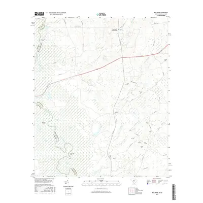
2017 Map of Bull Pond
USGS Topo · Published 2017About this map
The Savannah River forms a winding border between Screven County, Georgia, and Allendale County, South Carolina, defining a landscape of complex wetlands and oxbow lakes. Numerous water features like Dead River Lake, Brierpatch Lake, and Green Log Lake illustrate the shifting path of the river over time. Inland from the river bottoms, the terrain transitions to a patchwork of roads and small settlements, such as Concord Crossroads and Gravel Hill. For those researching local family history, the map is remarkably dense with burial sites, including Saint Pauls Cem, Magdalene Cem, and the Striker Cem. This network of small cemeteries, often associated with family names or local congregations like Antioch Cem, points to a long-established rural community organized around crossroads and watercourses like Brier Cr and The Gaul.
Find a feature on this map
63 named features on this map. Tap any name to fly to it.
Don’t see what you’re looking for? This feature index may not catch every label — zoom into the map to look around manually.
Map Details
Editions of this 2017 Bull Pond Map
This is the sole edition of this map. No revisions or reprints were ever made.
Other maps of this area

1919 · Allendale
USGS Topo · 1:62,500

1920 · Ellenton
USGS Topo · 1:48,000

1920 · Hilltonia
USGS Topo · 1:62,500

1920 · Peeples
USGS Topo · 1:62,500

1921 · Ellenton
USGS Topo · 1:62,500

1943 · Allendale
USGS Topo · 1:62,500

1943 · Hilltonia
USGS Topo · 1:62,500

1943 · Peeples
USGS Topo · 1:62,500

1943 · Augusta East
USGS Topo · 1:125,000

1943 · Millen
USGS Topo · 1:125,000