2017 Map of Bull Shoals
USGS Topo · Published 2017About this map
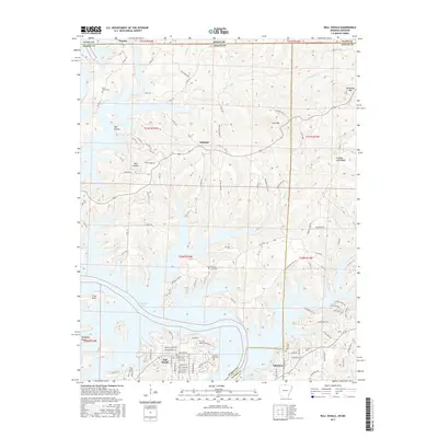
Bull Shoals Lake dominates this northern Arkansas landscape, its intricate, branching shoreline defining the development of Bull Shoals, Lakeview, and Oakland. The map reveals a transition from the water-oriented recreation and residential planning of the lakefront to the higher, winding ridges of the Ozarks. In the northern reaches, the Missouri-Arkansas state line cuts through the terrain just south of Pontiac, marking a jurisdictional boundary across the rural hills. Historical footprints are visible in the placement of the Price Place Cem and Promised Land Cem, located near Oakland and the Promise Land Ridge. The road network, including the Oakland Cutoff Rd and various Marion County routes, follows the natural contours of the land, navigating around prominent elevations like Long Mtn and Horseshoe Mtn.
Find a feature on this map
103 named features on this map. Tap any name to fly to it.
Don’t see what you’re looking for? This feature index may not catch every label — zoom into the map to look around manually.
Map Details
Editions of this 2017 Bull Shoals Map
This is the sole edition of this map. No revisions or reprints were ever made.
Other maps of this area

1890 · Mountain Home
USGS Topo · 1:125,000

1891 · Mountain Home
USGS Topo · 1:125,000

1893 · Yellville
USGS Topo · 1:125,000

1894 · Mountain Home
USGS Topo · 1:125,000

1903 · Yellville
USGS Topo · 1:125,000

1905 · Yellville
USGS Topo · 1:125,000

1929 · Yellville
USGS Topo · 1:125,000

1934 · Gainesville
USGS Topo · 1:48,000

1936 · Thornfield
USGS Topo · 1:48,000

1940 · Gainesville
USGS Topo · 1:62,500