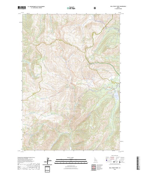
2024 Map of Bull Trout Point
USGS Topo · Published 2024About this map
Challis National Forest and Boise National Forest meet in this high-elevation wilderness, where the boundary between Valley, Boise, and Custer counties converges. The landscape is defined by its extensive drainage systems and prominent summits, most notably Bull Trout Point and Cape Horn Summit. Water is a central feature of the terrain, with Bull Trout Lake and Martin Lake situated in the eastern portion of the quadrangle. These lakes feed into an intricate network of streams including Warm Spring Creek and South Fork Cat Creek.
Find a feature on this map
40 named features on this map. Tap any name to fly to it.
Don’t see what you’re looking for? This feature index may not catch every label — zoom into the map to look around manually.
Map Details
Editions of this 2024 Bull Trout Point Map
This is the sole edition of this map. No revisions or reprints were ever made.
Other maps of this area

1891 · Bear Valley
USGS Topo · 1:125,000

1893 · Bear Valley
USGS Topo · 1:125,000

1957 · Challis
USGS Topo · 1:250,000

1960 · Challis
USGS Topo · 1:250,000

1963 · Challis
USGS Topo · 1:250,000

1972 · Bull Trout Point
USGS Topo · 1:24,000
1972 · Banner Summit
USGS Topo · 1:24,000

1972 · Cache Creek
USGS Topo · 1:24,000
1972 · Miller Mtn East
USGS Topo · 1:24,000
1972 · Eightmile Mtn
USGS Topo · 1:24,000