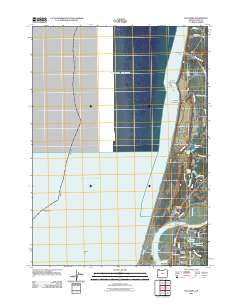
2011 Map of Bullards
USGS Topo · Published 2011About this map
The Coquille River meets the Pacific Ocean just north of Bandon, where the coastal landscape is defined by its transition from shifting sands to timber and local agriculture. This area features the community of Bullards and the southern reach of the Seven Devils coastal country, characterized by numerous small lakes and reservoirs like Chrome Lake, Round Lake, and Winters Reservoir. The presence of Cranberry Corners reflects the region's long-standing connection to cranberry farming in the boggy lowlands. On the coast, landmarks such as Coquille Rock and Fivemile Point mark the interface between the sea and the shore near Whisky Run Beach, while the Bullards Bridge provides a critical crossing over the river for travelers moving between the seaside settlements and the inland hills.
Find a feature on this map
41 named features on this map. Tap any name to fly to it.
Don’t see what you’re looking for? This feature index may not catch every label — zoom into the map to look around manually.
Map Details
Editions of this 2011 Bullards Map
This is the sole edition of this map. No revisions or reprints were ever made.
Other maps of this area

1896 · Coos Bay
USGS Topo · 1:125,000

1898 · Coos Bay
USGS Topo · 1:125,000

1900 · Coos Bay
USGS Topo · 1:125,000

1942 · Empire
USGS Topo · 1:62,500

1943 · Bandon
USGS Topo · 1:62,500

1944 · Empire
USGS Topo · 1:62,500

1944 · Bandon
USGS Topo · 1:62,500

1954 · Coos Bay
USGS Topo · 1:250,000

1958 · Coos Bay
USGS Topo · 1:250,000

1962 · Coos Bay
USGS Topo · 1:250,000