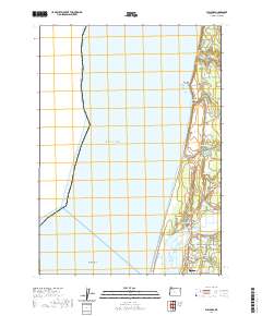
2020 Map of Bullards
USGS Topo · Published 2020About this map
The Coquille River meets the Pacific Ocean just north of Bandon, where the historic Bullards Bridge spans the water to the settlement of Bullards. This coastal landscape is defined by its transition from the surf of Merchants Beach and Whisky Run Beach to a network of inland lakes and streams, including Chrome Lake and Round Lake. The geography reveals a legacy of local habitation and industry, with features such as Bullards Cem and Spruce Hollow located near the riverbank. Further inland, water management is evident through the Spring Cr Reservoir and Winters Reservoir. The map tracks the winding course of Seven Devils Rd along the bluffs, providing a look at the transport corridors that have long connected the isolated points of Fivemile Point and the rocky outcropping of Coquille Rock to the harbor at Bandon.
Find a feature on this map
49 named features on this map. Tap any name to fly to it.
Don’t see what you’re looking for? This feature index may not catch every label — zoom into the map to look around manually.
Map Details
Editions of this 2020 Bullards Map
This is the sole edition of this map. No revisions or reprints were ever made.
Other maps of this area

1896 · Coos Bay
USGS Topo · 1:125,000

1898 · Coos Bay
USGS Topo · 1:125,000

1900 · Coos Bay
USGS Topo · 1:125,000

1942 · Empire
USGS Topo · 1:62,500

1943 · Bandon
USGS Topo · 1:62,500

1944 · Empire
USGS Topo · 1:62,500

1944 · Bandon
USGS Topo · 1:62,500

1954 · Coos Bay
USGS Topo · 1:250,000

1958 · Coos Bay
USGS Topo · 1:250,000

1962 · Coos Bay
USGS Topo · 1:250,000