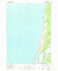
1970 Map of Bullards
USGS Topo · Published 1973About this map
The Coquille River meets the Pacific Ocean at this coastal crossroads, where the northern edge of Bandon and the riverfront community of Bullards serve as key landmarks. This 1970 snapshot of the Oregon coast illustrates a landscape defined by its unique wetlands and natural resources, featuring numerous Cranberry Bogs scattered near the shoreline. Historically significant sites such as the Bullards Cem and the Bullards Bridge provide essential points of reference for genealogists and local historians tracking family roots along the river's lower reaches.
Find a feature on this map
31 named features on this map. Tap any name to fly to it.
Don’t see what you’re looking for? This feature index may not catch every label — zoom into the map to look around manually.
Map Details
Editions of this 1970 Bullards Map
This is the sole edition of this map. No revisions or reprints were ever made.
Other maps of this area

1896 · Coos Bay
USGS Topo · 1:125,000

1898 · Coos Bay
USGS Topo · 1:125,000

1900 · Coos Bay
USGS Topo · 1:125,000

1942 · Empire
USGS Topo · 1:62,500

1943 · Bandon
USGS Topo · 1:62,500

1944 · Empire
USGS Topo · 1:62,500

1944 · Bandon
USGS Topo · 1:62,500

1954 · Coos Bay
USGS Topo · 1:250,000

1958 · Coos Bay
USGS Topo · 1:250,000

1962 · Coos Bay
USGS Topo · 1:250,000