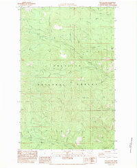
1983 Map of Bulldog Mtn
USGS Topo · Published 1983About this map
Colville National Forest dominates this northern Washington landscape, showing a complex network of high ridges and drainage basins in Ferry County. The topography is defined by significant elevations such as Bulldog Mtn and Dry Mountain, with the terrain falling away into deep valleys carved by Bear Creek, Hunter Creek, and Boulder Creek. This 1983 provisional edition provides a detailed look at the land use within the national forest, where 4WD tracks represent the primary method of human ingress through the timbered slopes. Notable landmarks like Taylor Ridge and North Boulder Ridge separate distinct hydrological zones, including the waters of Echo Creek and Laddie Creek. The presence of several labeled Borrow Pits suggests localized road maintenance or industrial activity within the forest boundaries during the early 1980s.
Find a feature on this map
31 named features on this map. Tap any name to fly to it.
Don’t see what you’re looking for? This feature index may not catch every label — zoom into the map to look around manually.
Map Details
Editions of this 1983 Bulldog Mtn Map
This is the sole edition of this map. No revisions or reprints were ever made.
Other maps of this area

1936 · Marcus
USGS Topo · 1:96,000

1942 · Marcus
USGS Topo · 1:125,000

1948 · Sherman Peak
USGS Topo · 1:62,500

1948 · Kettle Falls
USGS Topo · 1:62,500

1948 · Orient
USGS Topo · 1:62,500

1948 · Togo Mountain
USGS Topo · 1:62,500

1951 · Togo Mountain
USGS Topo · 1:62,500

1951 · Sherman Peak
USGS Topo · 1:62,500

1951 · Orient
USGS Topo · 1:62,500

1951 · Kettle Falls
USGS Topo · 1:62,500