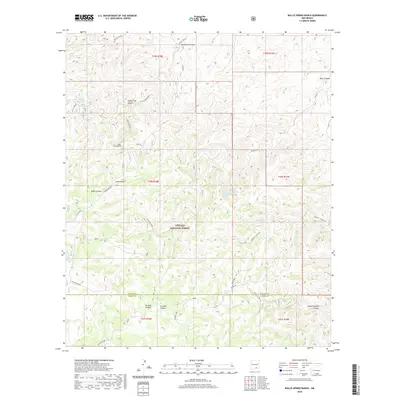
2020 Map of Bullis Spring Ranch
USGS Topo · Published 2020About this map
Lincoln National Forest land defines the southern portion of this territory, where the complex canyon systems of the Sacramento Mountains transition into high-altitude ranching country. The presence of Bullis Spring Ranch and several named water sources like Bullis Spring, West Bear Springs, and East Bear Springs underscores the vital importance of dependable water in this arid landscape. Man-made infrastructure is represented by a series of livestock improvements, including the Steve Water Storage Tank, Indian Water Tank, and Foster Tank. This network of tanks and seeps, such as Sargent Seep, supported the local cattle industry within the national forest boundaries. The terrain is marked by significant topographical shifts along the Guadalupe Rim, with the county line between Chaves and Otero counties crossing the southern portion of the survey.
Find a feature on this map
35 named features on this map. Tap any name to fly to it.
Don’t see what you’re looking for? This feature index may not catch every label — zoom into the map to look around manually.
Map Details
Editions of this 2020 Bullis Spring Ranch Map
This is the sole edition of this map. No revisions or reprints were ever made.
Other maps of this area

1943 · Texas Hill
USGS Topo · 1:62,500

1945 · Texas Hill
USGS Topo · 1:62,500

1954 · Carlsbad
USGS Topo · 1:250,000

1958 · Carlsbad
USGS Topo · 1:250,000

1963 · Tanner Ranch
USGS Topo · 1:24,000

1963 · Panama Ranch
USGS Topo · 1:24,000

1965 · Lewis Peak NE
USGS Topo · 1:24,000

1965 · Lewis Peak
USGS Topo · 1:24,000

1965 · Bullis Spring Ranch
USGS Topo · 1:24,000

1965 · Pinon Ranch
USGS Topo · 1:24,000