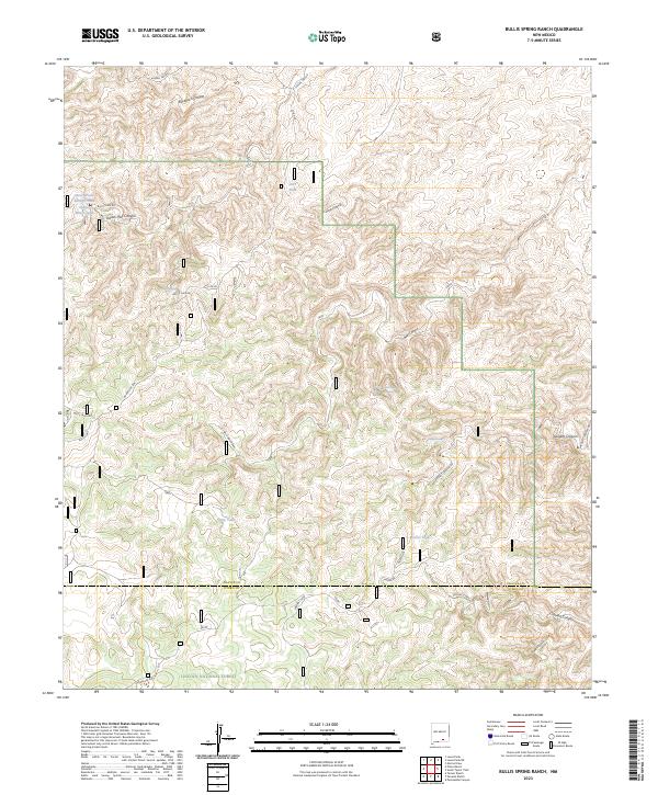
2023 Map of Bullis Spring Ranch
USGS Topo · Published 2023About this map
Lincoln National Forest land defines the southern reaches of this landscape, where the dramatic elevation change of the Guadalupe Rim creates a sharp topographical divide. This contemporary survey of Chaves and Otero counties highlights a network of vital water sources necessary for life in the high desert, including Bullis Spring, Sargent Seep, and the West Bear Springs. The map reveals a remote ranching and forest environment where access is limited to primitive routes like Bullis Lake Rd and Sargent Canyon Rd. Cattle tanks such as Foster Tank and Crip Tank are scattered throughout the deep incisions of Buckhorn Canyon and Indian Trail Canyon, underscoring the reliance on seasonal and developed water catchments for the region's agricultural use.
Find a feature on this map
36 named features on this map. Tap any name to fly to it.
Don’t see what you’re looking for? This feature index may not catch every label — zoom into the map to look around manually.
Map Details
Editions of this 2023 Bullis Spring Ranch Map
This is the sole edition of this map. No revisions or reprints were ever made.
Other maps of this area

1943 · Texas Hill
USGS Topo · 1:62,500

1945 · Texas Hill
USGS Topo · 1:62,500

1954 · Carlsbad
USGS Topo · 1:250,000

1958 · Carlsbad
USGS Topo · 1:250,000

1963 · Tanner Ranch
USGS Topo · 1:24,000

1963 · Panama Ranch
USGS Topo · 1:24,000

1965 · Lewis Peak NE
USGS Topo · 1:24,000

1965 · Lewis Peak
USGS Topo · 1:24,000

1965 · Bullis Spring Ranch
USGS Topo · 1:24,000

1965 · Pinon Ranch
USGS Topo · 1:24,000