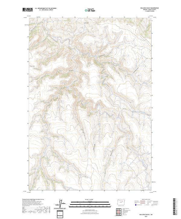
2024 Map of Bullock Gulch
USGS Topo · Published 2024About this map
Linder Basin and the surrounding drainage network define this high-elevation corner of Grant County, where the landscape is carved by a complex system of gulches and creeks. The terrain is marked by deep incisions such as Jones Canyon and Bullock Gulch, showing a rugged topography that has historically dictated the movement of water and people. A sparse network of tracks, including Pass Creek Ln and Piquet Rd, follows the natural contours of the land, connecting remote sections of the townships near Pass Creek.
Find a feature on this map
21 named features on this map. Tap any name to fly to it.
Don’t see what you’re looking for? This feature index may not catch every label — zoom into the map to look around manually.
Map Details
Editions of this 2024 Bullock Gulch Map
This is the sole edition of this map. No revisions or reprints were ever made.
Other maps of this area

1949 · Long Creek
USGS Topo · 1:62,500

1950 · Ritter
USGS Topo · 1:62,500

1951 · Long Creek
USGS Topo · 1:62,500

1951 · Courtrock
USGS Topo · 1:62,500

1951 · Monument
USGS Topo · 1:62,500

1952 · Ritter
USGS Topo · 1:62,500

1955 · Canyon City
USGS Topo · 1:250,000

1959 · Canyon City
USGS Topo · 1:250,000

1980 · Monument
USGS Topo · 1:100,000
1990 · Steet Mtn.
USGS Topo · 1:24,000