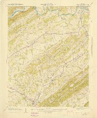
1940 Map of Bulls Gap
USGS Topo · Published 1940About this map
Grassy Valley and the winding course of the Holston River define this rural landscape as it appeared just before the mid-century. The Southern railroad provides a primary transportation corridor, linking the settlements of Bulls Gap and Persia with the river's agricultural trade. Along the water, traditional river crossings like Price Ferry remain prominent alongside industrial landmarks such as Austins Mill and the treacherous Drumhole Shoals.
Find a feature on this map
109 named features on this map. Tap any name to fly to it.
Don’t see what you’re looking for? This feature index may not catch every label — zoom into the map to look around manually.
Map Details
Editions of this 1940 Bulls Gap Map
2 editions found
Other maps of this area

1883 · Morristown
USGS Topo · 1:125,000

1892 · Greeneville
USGS Topo · 1:125,000

1893 · Morristown
USGS Topo · 1:125,000

1895 · Morristown
USGS Topo · 1:125,000

1896 · Greeneville
USGS Topo · 1:125,000

1904 · Greeneville
USGS Topo · 1:125,000

1935 · Surgoinsville
USGS Topo · 1:48,000

1935 · Rogersville
USGS Topo · 1:48,000

1935 · Lee Valley
USGS Topo · 1:24,000

1935 · McCloud
USGS Topo · 1:24,000