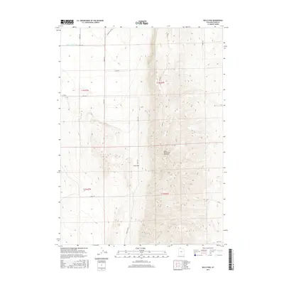
2017 Map of Bulls Pass
USGS Topo · Published 2017About this map
The North Promontory Mountains dominate this high-desert landscape in northern Utah, where the rugged terrain is carved by the Hansel Valley Wash in the northwest. This 2017 survey details the remote cattle country and transit corridors of Box Elder County, centered on the strategic topographical gap of Bulls Pass. The area is defined by its rectilinear grid of rural roads, including N Hansel Valley Rd and Sunset Pass Rd, which provide access to high-elevation rangelands. The map reveals the intersection of public land survey systems across township boundaries like t13n r6w and t12n r6w, documenting the modern utility of a landscape that remains sparsely inhabited and largely agricultural.
Find a feature on this map
20 named features on this map. Tap any name to fly to it.
Don’t see what you’re looking for? This feature index may not catch every label — zoom into the map to look around manually.
Map Details
Editions of this 2017 Bulls Pass Map
This is the sole edition of this map. No revisions or reprints were ever made.
Other maps of this area

1954 · Brigham City
USGS Topo · 1:250,000

1958 · Brigham City
USGS Topo · 1:250,000

1961 · Thatcher Mountain
USGS Topo · 1:62,500

1962 · Brigham City
USGS Topo · 1:250,000

1968 · Lake Ridge
USGS Topo · 1:24,000

1968 · Sunset Pass
USGS Topo · 1:24,000

1968 · Howell
USGS Topo · 1:24,000

1968 · Salt Wells
USGS Topo · 1:24,000

1968 · Ridgedale Pass
USGS Topo · 1:24,000

1968 · Rattlesnake Pass
USGS Topo · 1:24,000