
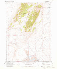
1968 Map of Salt Wells
USGS Topo · Published 1972About this map
Salt Wells Flat and the surrounding basin floor define the southern portion of this 1960s landscape in Box Elder County. The terrain is dominated by the steep rise of the Hansel Mountains, which separate the expansive Sage Valley to the west from the lower Hansel Valley to the east. This area of northern Utah shows a landscape largely shaped by its hydrology, with Hansel Valley Wash draining through the eastern corridor toward the salt flats.
Find a feature on this map
13 named features on this map. Tap any name to fly to it.
Don’t see what you’re looking for? This feature index may not catch every label — zoom into the map to look around manually.
Map Details
Editions of this 1968 Salt Wells Map
2 editions found
Other maps of this area

1954 · Brigham City
USGS Topo · 1:250,000

1958 · Brigham City
USGS Topo · 1:250,000

1962 · Brigham City
USGS Topo · 1:250,000

1968 · Lake Ridge
USGS Topo · 1:24,000

1968 · Sunset Pass
USGS Topo · 1:24,000

1968 · Monument Point
USGS Topo · 1:24,000

1968 · Rattlesnake Pass
USGS Topo · 1:24,000

1968 · Snowville
USGS Topo · 1:24,000
1968 · Bulls Pass
USGS Topo · 1:24,000

1968 · Monument Peak
USGS Topo · 1:24,000