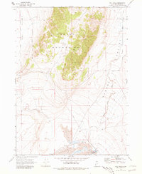
1968 Map of Salt Wells
USGS Topo · Published 1981About this map
The Hansel Mountains dominate this 1968 landscape, forming a prominent north-south ridge that divides the western Sage Valley from the eastern Hansel Valley. This arid terrain in Box Elder County reflects a late-century industrial footprint in a largely uninhabited space, marked by a significant Pipeline cutting across the mountain slopes and a Radio Tower positioned on one of the higher peaks. To the south, the topography flattens dramatically into the Salt Wells Flat and Mud Flat, where the water of Salt Wells serves as a lone hydrological landmark. The map tracks the drainage of Hansel Valley Wash as it meanders through the eastern valley, providing a detailed record of the desert hydrology and land use during this era. Traceable markers like a Borrow Pit indicate localized excavation and utility maintenance in this high-desert environment.
Find a feature on this map
10 named features on this map. Tap any name to fly to it.
Don’t see what you’re looking for? This feature index may not catch every label — zoom into the map to look around manually.
Map Details
Editions of this 1968 Salt Wells Map
2 editions found
Other maps of this area

1954 · Brigham City
USGS Topo · 1:250,000

1958 · Brigham City
USGS Topo · 1:250,000

1962 · Brigham City
USGS Topo · 1:250,000

1968 · Lake Ridge
USGS Topo · 1:24,000

1968 · Sunset Pass
USGS Topo · 1:24,000

1968 · Monument Point
USGS Topo · 1:24,000

1968 · Salt Wells
USGS Topo · 1:24,000

1968 · Rattlesnake Pass
USGS Topo · 1:24,000

1968 · Snowville
USGS Topo · 1:24,000
1968 · Bulls Pass
USGS Topo · 1:24,000