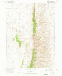
1968 Map of Bulls Pass
USGS Topo · Published 1972About this map
North Promontory Mountains dominate this high-desert landscape, creating a dramatic vertical divide between the surrounding basin lands. Surveyed in the late 1960s, the terrain is defined by the critical passage at Bulls Pass, a natural corridor through the ridgeline. The western portion of the map covers the expansive Hansel Valley, where the land use shifts toward agricultural and industrial infrastructure. Sparse but vital markers of human activity include a Storage Bin and a Well, alongside extractive sites like a Sandpit and Gravel Pit. A network of unpaved transit is represented by a Jeep Trail, illustrating how ranchers and miners navigated this isolated stretch of Box Elder County before modern developments altered the local backcountry routes.
Find a feature on this map
8 named features on this map. Tap any name to fly to it.
Don’t see what you’re looking for? This feature index may not catch every label — zoom into the map to look around manually.
Map Details
Editions of this 1968 Bulls Pass Map
2 editions found
Other maps of this area

1954 · Brigham City
USGS Topo · 1:250,000

1958 · Brigham City
USGS Topo · 1:250,000

1961 · Thatcher Mountain
USGS Topo · 1:62,500

1962 · Brigham City
USGS Topo · 1:250,000

1968 · Lake Ridge
USGS Topo · 1:24,000

1968 · Sunset Pass
USGS Topo · 1:24,000

1968 · Howell
USGS Topo · 1:24,000

1968 · Salt Wells
USGS Topo · 1:24,000

1968 · Ridgedale Pass
USGS Topo · 1:24,000

1968 · Rattlesnake Pass
USGS Topo · 1:24,000